Push your limits this summer with an exhilarating outdoor pursuit.
In 2012, Paul Reeve, an experienced mountaineer set up Sky Blue Adventures (www.skyblueadventures.com.) Paul has been an active hill walker, backpacker, and mountain biker for over 30 years and has led expeditions in the UK, Ireland, Norway, Morocco, Tanzania, Australia, Peru, Japan, Nepal, and the United States, so, if you’re looking for a trip with a difference in 2022 – why not check out these UK itineraries and take the time to witness breath-taking scenery on a holiday with a difference.
Snowdon Challenge
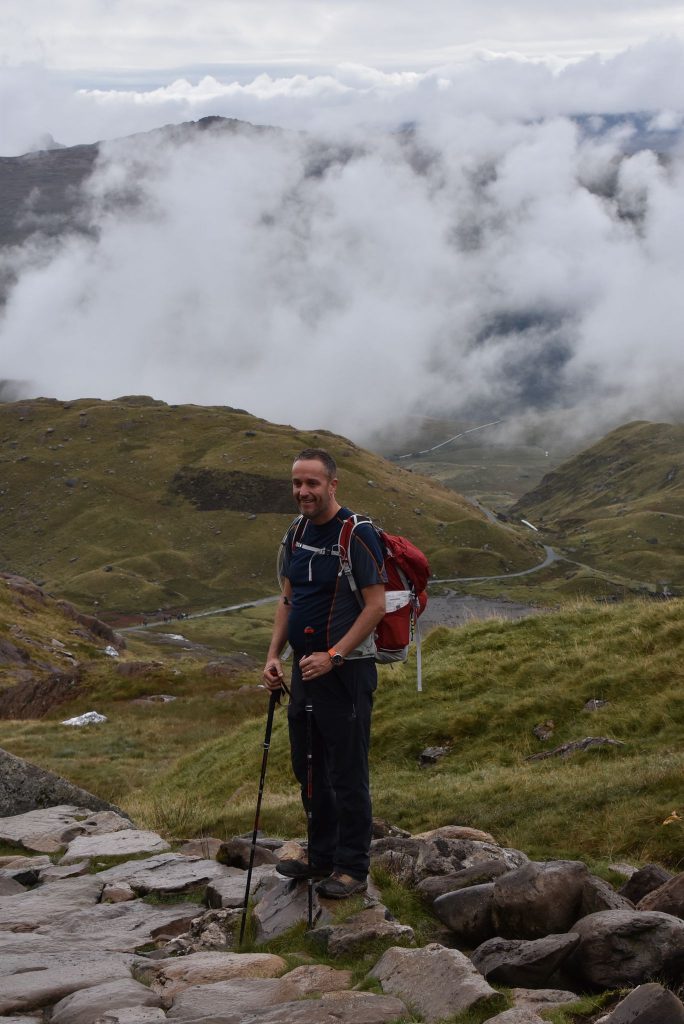
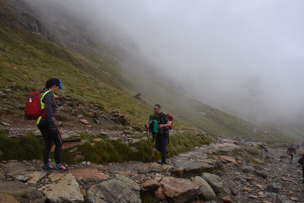
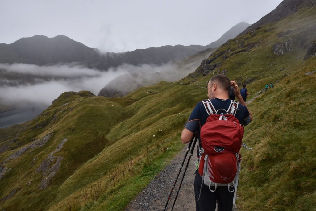
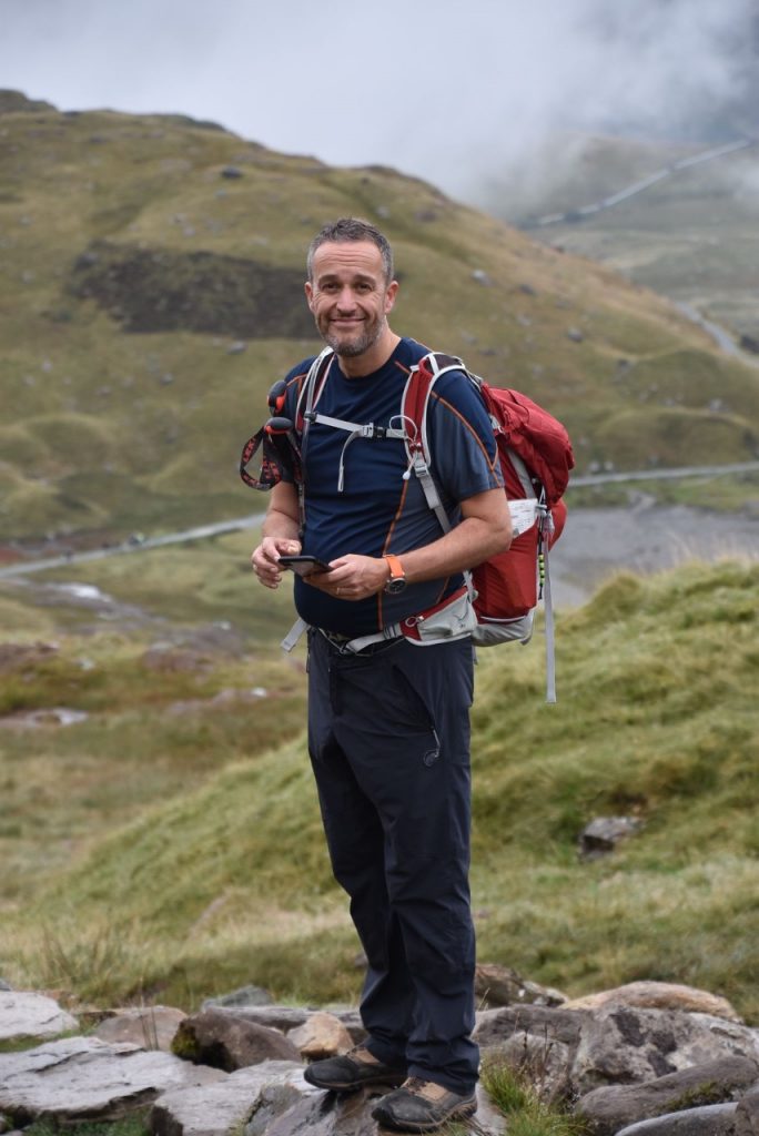
The Snowdon Climbing Challenge is undoubtedly our most popular charity event. If you are seeking to create a real buzz, while smashing your fundraising targets, then this could be the event for you. This highly popular challenge involves trekking to the summit of Snowdon via the Pyg track and walking over the summit and descending the Llanberis path.
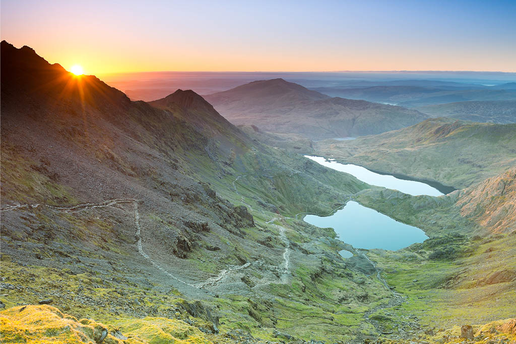
Snowdon is the highest mountain in Wales and England. Its Welsh name, Yr Wyddfa, means tomb or monument. Legend has it that it is the tomb of the ogre Rhita Gawr, who supposedly met his end when King Arthur climbed to the top of Snowdon and killed him. Snowdon is a part of a close-knit family of jagged peaks and offers views across Snowdonia, Anglesey, Pembrokeshire, and Ireland. The whole area has been mined for copper since the Bronze Age, and you will find the ruins of old mine buildings and tramways across the whole mountain.
If you are moderately fit, climbing Snowdon is definitely within your reach. Although Snowdon is one of the highest mountains in the UK and the tallest mountain in Wales, it is probably the friendliest for the novice walker to ascend. In the summer months you can even rest your feet and grab a welcome beverage in the café at the summit. And if you’re feeling tired after the strenuous climb up you can always get the train back down.
On the Day
Grade: Medium
Start Location: Outside Llanberis Railway Station
Finish Location: Llanberis
Vehicle: Minibuses to shuttle participants between (Llanberis and Pen y Pass)
Guides: Qualified Mountain Leaders (First aid qualified and highly experienced)
08:00 – Meet Sky Blue Adventures Team at Llanberis railway Station.
08:15 – Travel in Private minibus to Pen y Pass car park
08:30 – After a team briefing commence climb on the Pyg Track
11:00 – Reach Snowdon Summit and enjoy the views from the Summit Café
11:30 – Start descent down the Llanberis Path
15:00 – Arrive in Llanberis and finish challenge
Pyg Track Ascent
The Pyg Track is one of the main walking routes on Snowdon and known as the ‘classic’ route. Short, scenic, steeped in history and with a tough final ascent, this is a fantastic route for both beginners and experienced walkers.
The Pyg Track is the shortest route to the top of Snowdon with the least amount of vertical ascent (but still a tough walk). The Pyg Track is simple to follow, and the route is well maintained making this a good route for less experienced hillwalkers.
The scenery on the Pyg Track is possibly the best of any of the other routes which is why this route is so popular.
The Miners Track runs lower down and parallel to the Pyg Track and gives a slightly different descent (if you want) and takes you down to the impressive Snowdon lakes.
Nobody knows for certain why this path is called the Pyg Track. It’s possible that it was named after the pass it leads through, Bwlch y Moch (translated Pigs’ Pass) as the path is sometimes spelled ‘Pig Track’. Or, maybe it’s because it was used to carry ‘pyg‘ (black tar) to the copper mines on Snowdon. Another possible explanation is the path was named after the nearby Pen y Gwryd Hotel, popular amongst the early mountain walkers.
Distance: 3.5 miles – 5.5 Km Ascent: 2,372 feet – 723 metres Time: About 3 hours
Hafod Eyri – Summit Cafe
Snowdon Summit’s Visitor Centre, Hafod Eryri, first opened in June 2009. It receives half a million visitors a year on average and it’s not hard to see why. On a clear day the views can stretch as far as Ireland. On arrival at the Summit, railway passengers and walkers are welcomed into a modern contemporary environment, an amazing feat of engineering on the top of a mountain. This unique building was built to withstand the mountain weather conditions, whilst blending in with its natural surroundings. The building is clad in oak and granite, and panoramic windows reveal wonderful views to the valleys below. During your lunch break you can venture to the cairn of the highest mountain in Wales and England, 1085m above sea level.
Llanberis Path Descent
Llanberis Path is the longest and most gradual of the six main paths to the summit of Snowdon, and offers fantastic views of Cwm Brwynog, Llanberis and over the Menai straights towards Anglesey.
The path mainly follows the Snowdon Mountain Railway track, and goes by Hebron, Halfway and Clogwyn stations. Before the railway was opened in 1896, visitors employed guides to lead them to the summit along this path on mule- back.
A remarkable geological feature can be seen from the Llanberis path, the Clogwyn Du’r Arddu syncline. The syncline was formed over thousands of years, as the earth moved and transformed horizontal deposits into vertical layers of rock.
Distance: 4.5 miles – 7.25Km Descent: 3,199 feet – 975 metres Time: About 3 hours
Suggested Accommodation
Llanberis YHA –
Heights Bunkhouse
Victoria Hotel
Padarn Hotel
Y Gwynedd Inn & Bunkhouse
Scafell Pike
The Scafell Pike Climbing Challenge is undoubtedly one of the most popular charity events. If you are seeking to create a real buzz, while smashing your fundraising targets then this could be the event for you. This highly popular challenge involves trekking to the summit of Scafell Pike, from Wasdale.
DAY ONE:
This is the popular walk up Scafell Pike from Wasdale Head, and is the usual three peaks route up Scafell pike. It starts from the NT car park by Wastwater. This is the most popular route from Wasdale Head and provides spectacular view across the surrounding mountains and Wastwater Lake.
Scafell Pike Facts:
Highest Mountain in England at 978 m / 3209 ft
One of the busiest Mountain in the UK with over 100,000 people climbing the mountain from Wasdale Head each year
Summit Boulder Field
Route from Wasdale Head is part of the National 3 Peaks challenge
3.5 miles up and 4.5 miles down
Height gained 880 metres / 2,887 feet
On the Day:
Grade: Medium
Start Location: Wasdale Head
Finish Location: Wasdale Head
Guides: Qualified Mountain Leaders (First aid qualified and highly experienced)
09:00 – Meet Up Sky Blue Adventures team at National Trust Car Park at Wasdale Head
09:15 – Commence climb on Scafell Pike
12:00 – Groups start to arrive at Summit. Enjoy the views from the summit and have a break
12:30 – Groups start descent back to Wasdale Head
16:00 – Groups arrives back at Wasdale Head NT car park
17:00 – Drink and Meal at Wasdale Head Inn (optional)
- The participants will be divided into groups of 10
- Each group will have a maximum of 10 participants to 1 Mountain Leader (ML)
- The ML will be responsible for the welfare of the group and will walk at the pace of the slowest person within the group
- An extra ML will remain at the back of the group to act as a sweeper
- The ML will have overall responsibility for their group and all participants must follow their instructions to ensure the overall safety of the whole group
Wasdale Head Route
The walk starts from the National Trust Car Park at Wastwater, next to the Campsite. The route sets off along Lingmell Beck, crossing it and then following it steeply uphill.
After 1.5km, the path fords Lingmell Beck, with the crossing not overly obvious, but straightforward.
Once you have crossed Lingmell Beck, you have got an even steeper ascent up Brown Tongue to follow. It’s steep, but thankfully only around half a kilometre and the steepest section on the route.
After Brown Tongue, the route relents, but the path begins threading and the route ahead may not be immediately apparent, especially in mist. You veer left towards a large cairn at the top of Brown Tongue across Hollow Stones.
The next section of path is steady to Lingmel Col, and easier on the legs than what you’ve already walked up.
After around 1.5km, you should reach Lingmel Col where the Path turns right. It is joined here by the Corridor Route, just make sure you don’t join the Corridor Route! The final ascent has a largely clear path, if a bit loose in places, that zig zags its way up the final 200m of ascent.
The summit plateau is finally reached, with the summit itself being a slight climb. There’s a rather strangely placed trig point next to the higher summit cairn. Jostle here with everyone else in order to bag England’s highest point, and an extensive view of the Lakeland Fells.
You will descend by the same route.
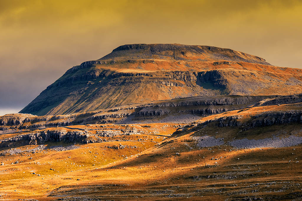
The Yorkshire Three Peaks
Known as Britain’s classic hillwalking challenge – this is a tough 24-mile walk through the idyllic Yorkshire Dales, where you summit the peaks of Pen-y-ghent, Whernside and Ingleborough, in under 12-hours.
Yorkshire 3 Peak Facts:
- Yorkshire 3 Peaks situated in the Yorkshire Dales
- Summit Pen-y_Ghent – 697m, Whernside 736m and Ingleborough 723m
- 24-mile circular route
- 12-hour completion time
- Fastest recorded time is 2 hours 29 minutes 53 secs
On the Day:
Grade: Medium/Hard
Start Location: Horton-in-Ribblesdale
Finish Location: Horton-in-Ribblesdale
Guides: Qualified Mountain Leaders (First aid qualified and highly experienced)
06:30 – Meet Sky Blue Adventures Team at Horton in Ribblesdale
07:00 – After a team briefing commence first climb of the day on Pen y Ghent
08:20 – Reach Pen-y-ghent Summit and enjoy the views
12:00 – Stop for Lunch
13:30 – Arrive on Whernside Summit
16:30 – Reach Ingleborough Summit
19:00 Arrive back in Horton-in-Ribblesdale
Yorkshire 3 Peaks – Pen-y-ghent, Whernside and Ingleborough
Walk south out of the village passing the Golden Lion pub and church and cross a small stream. Then turn left up a minor tarmac road. Follow this up towards Brackenbottom and just before reaching some buildings take a footpath on your left signed to Pen-y-ghent.
Climb steadily up through fields with Pen-y-ghent ahead of you. The final section of the route to the summit is steeper for a while before reaching the trig point and shelter.
Cross the wall at the summit and follow the clear path heading roughly north. This zig zags down, passing the gash of Hunt Pot, to reach the head of a walled lane.
Carry straight on to follow the new path over Whitber Hill to reach a clear track. Turn right and follow this for 1.5km (1 mile) and then take the path on the left towards Birkwith cave. This emerges onto a rough tarmac track, turn left and then right onto an unsurfaced track towards Nether Lodge.
After Nether Lodge follow the long access track up to the B6479. Turn right and follow this to Ribblehead – the road can be busy, and you need to take care.
From the road take one of the paths that head towards Ribblehead viaduct. Keep the viaduct on your left and follow an obvious path which runs alongside the railway.
After 2.5km (1.5 miles) the path crosses over the railway besides an aqueduct. The path now starts to climb towards Grain Head. Leave this path by taking the signed route to the left which climbs slowly on to the ridge, which is then followed up to the summit.
To descend continue to follow the ridge path southwards for 1.5km (1 mile) and then turn left on the signed path down to Bruntscar. Follow the lane towards the valley to reach the B6255. Turn left, go past the Old Hill Inn, and then right on to a level grassy path. Take care as this road can be busy and traffic fast moving.
This goes through a number of fields and then through an area of limestone pavement and past the shakehole known as Braithwaite Wife Hole. The obvious path continues towards Ingleborough climbing gently at first and then steeply to reach the summit plateau.
In poor weather it is easy to leave the plateau in the wrong direction. If needed from the trig point use a bearing of 070’ until the ground starts to steepen, then follow a bearing of 100’.
From the summit plateau follow the path east heading towards Horton-in-Ribblesdale. This drops slowly towards the valley. Continue past a ruined cottage and keep on the main path. This crosses another major path and continues along the obvious feature of Sulber Nick – a small straight valley. There are then only a few fields to go before the path reaches Horton train station with the car park – and pub – a short distance further on.
Accommodation
Set in 10 acres of beautiful, protected countryside, The Dalesbridge is the ideal venue to stay and explore the Yorkshire Dales National Park and Bowland Area of Outstanding Natural Beauty. A selection of 4 and 6 berth walkers’ cabins are available.
For more information visit: www.dalesbridge.co.uk